Technology is transforming the surveying industry by enabling surveyors to collect more data, faster, and with greater accuracy. This, in turn, is making it easier to design, analyze, and build complex projects, while reducing costs and improving safety.
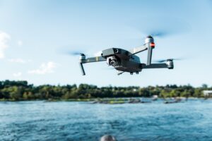
The use of drones, or unmanned aerial vehicles (UAVs), is changing the surveying industry in significant ways. Drones have become an indispensable tool for surveyors and are rapidly replacing traditional surveying methods. In this blog post, we’ll explore how drones are revolutionizing the surveying industry and the benefits/disadvantages of drone surveys.
Benefits:
One of the most significant advantages of drone surveying is that it is more cost effective. Traditional surveying methods can be expensive, especially when surveying large or remote areas. Drones, on the other hand, are relatively inexpensive and can be deployed quickly and easily. This makes them an excellent option for surveying projects with limited budgets.
Another bonus is that UAVs offer improved efficiency. Drones can cover large areas quickly and accurately, collecting data and generating high-quality maps in a fraction of the time it takes to survey the same area using traditional methods. This means surveyors can complete projects faster and with higher accuracy, reducing project costs and improving turnaround times.
Drones are equipped with first-rate cameras and sensors, which allow them to capture information and images from hard-to-reach and hazardous areas. This means surv
eyors can avoid having to enter potentially dangerous environments, such as construction sites or remote areas. This improves safety and reduces the risk of injuries or accidents.
Because of these advanced cameras and sensors, drones are also capable of capturing top-notch images and data with extreme accuracy. This makes them an ideal tool for surveying projects that require high levels of accuracy, such as construction sites, industrial builds, or mining operations. By using drones, surveyors can produce detailed and accurate maps an

d models that are essential for project planning and management.
Drone surveys are capable of transmitting data in real-time, which means surveyors can immediately review and analyze data while still in the field. This is particularly useful for large and complex projects where surveyors need to make decisions quickly. Real-time data also allows for faster project completion and more efficient resource allocation, what could take hours on foot could be dramatically reduced with the use of a drone.
Disadvantages:
While drones offer many advantages for surveying, there are also some potential negatives to consider. Drones can be impacted by weather conditions such as wind, rain, and snow, which can affect the accuracy and safety of the survey. In some cases, weather conditions may prevent a drone survey from taking place altogether.
Drones have a limited battery life, which means that they can only operate for a certain amount of time before needing to be recharged. This can be limiting for larger survey sites where multiple flights may be necessary to complete the survey. They are also subject to a complex and evolving set of regulations, which can vary by zone, city, or jurisdiction. Surveyors need to be aware of these regulations and ensure that they comply with them to avoid penalties or fines while drone surveying.
Operating drones for surveying requires specialized technical expertise and training, which can be a barrier to entry for some surveying firms. It’s important to have a skilled pilot and technician to operate and maintain the equipment properly.
One thing to consider when drone surveying is privacy concerns, particularly if drones are flying over residential or public areas. It’s important to think about the potential impact of drone surveys on neighbouring properties and obtain necessary permissions and permits.
Drones are changing the surveying industry by providing surveyors with an efficient, cost-effective, and safe way to collect high-quality data. The technology offers a range of benefits, although they do come with a few drawbacks as well. Overall it is dependent on your specific project on whether or not a drone would be necessary, a decision we can easily help you with!
As the use of drones continues to grow, we can expect to see even more changes in the way surveying is done, and the benefits and drawbacks they offer will become even more apparent.
Arc Surveys
Have any further questions about the advancements of Drone Surveys? Give us a call (780-800-1260) or drop us an email at info@arcsurveys.ca. We’ll help you get a better understanding on how to get the best information towards completing your next survey project.


